
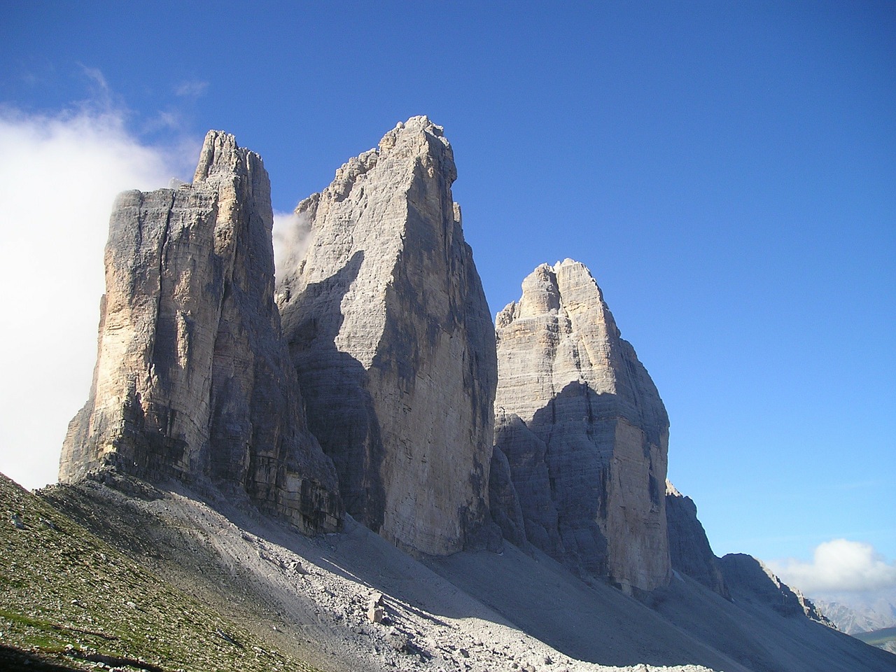
Tre Cime di Lavaredo, Italy, Part 2
I saw an amazing photo on Bing wallpaper and thought why not try to fly there and see how it is experienced in MSFS Flight Sim?
Here are similar photos:
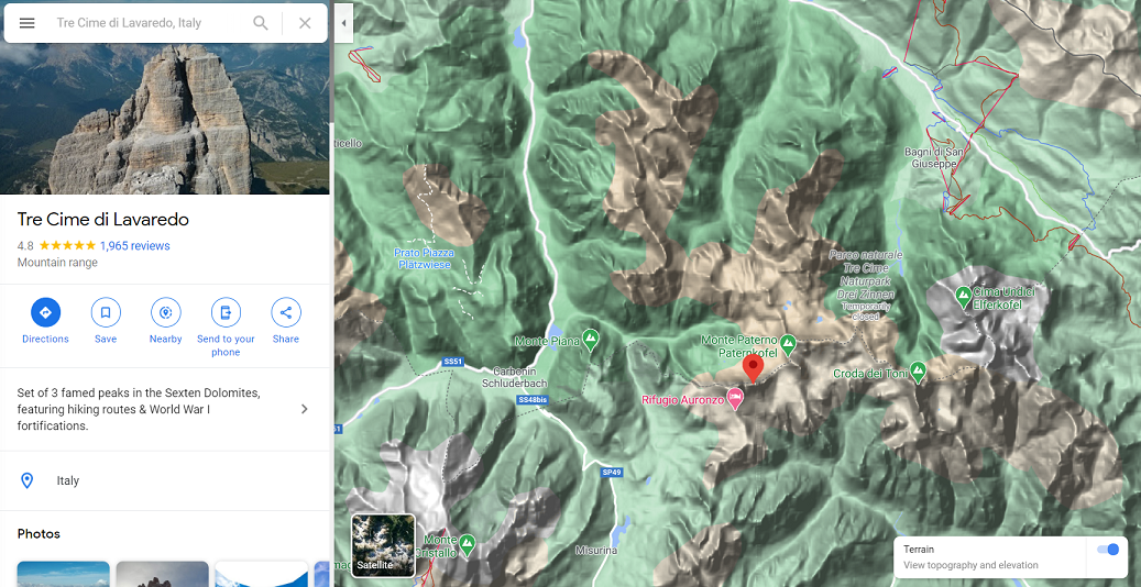
It will be interesting to compare Google Earth to Flight Simulator.
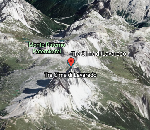
Map data © Google and Maxar Technologies, Landsat / Copernicus, CNES / Airbus, GeoBasis-DE/BKG
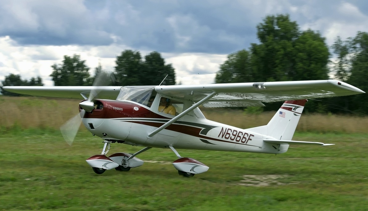
Although GPS is everywhere today, I learned how to fly in the late 1970s in a Cessna 150, without GPS:
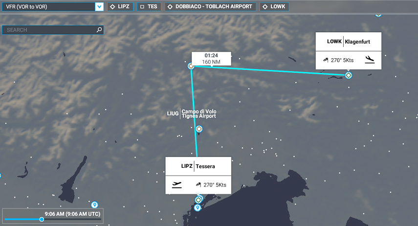
But we did have radios! The VHF omni-range system, called VOR stations, broadcast radio signals that you could use to obtain the direction and sometimes the distance from the aircraft to the station. So I plotted triangulation radials from the nearest VOR stations: Venice, Italy and Klagenfurt, Austria. They are marked with compass roses on the chart:
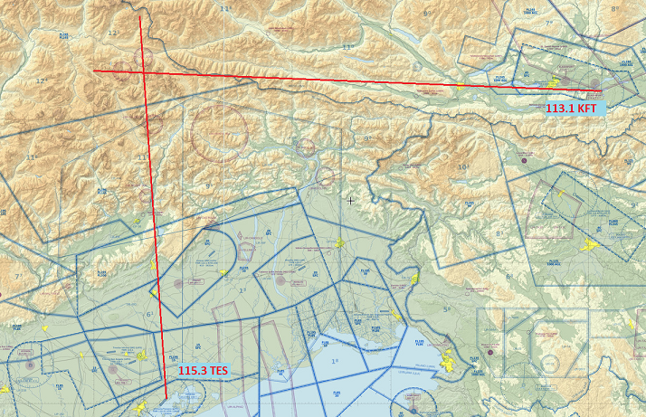
US Federal Aviation Administration Aeronautical Information Services
The distance is about 100 miles from the stations, but VOR range is limited to about 30 miles, and with the mountains I don't think the line-of-sight radio signal would actually reach the aircraft. Plotting the triangulation was interesting but not going to be really useful. I would have to use GPS and fly through the valleys.
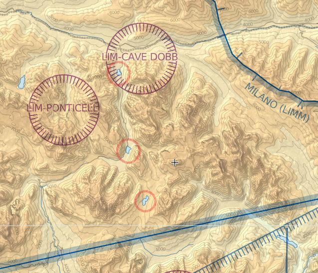
So, how to pinpoint the destination location on an actual VFR chart? No drivable road goes there. For Europe I could not find a web site that lets you input GPS coordinates or that integrates road maps with VFR aviation charts showing terrain. I also think that navigating by little winding roads in mountain valleys might be tricky. In the USA I did find this site: iFlightPlaner.com. As you flip between different map types it keeps your view georegistered. But not for Europe.
On the digital VFR chart I found three lakes to help pinpoint exactly where the Tre Cime destination was. + marks the spot!
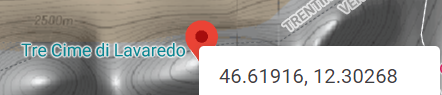
We can get the GPS coordinates, as decimal lat-long from Google Maps
Finally, I made a flight plan in the simulator, departing from Venice, Italy and ending at in Klagenfurt, Austria.
End of part 1