
The goal for this flight is to get from Innsbruck, Austria to Sion, Switzerland. Sion is the closest airport to Zermatt, a small town at the base of the Matterhorn.
The airplane would have to fly in the valleys, since it could not climb over the mountains. The route would be much longer than the 200 nm straight line distance. Also, the valleys don't all connect, so at times the we would have to climb to get over, or through, a mountain pass.
The distance line was useful since it matched the GPS flight plan, and helped to locate my spot on the Google terrain map. The flight simulator does show some terrain but no town or road names.

Sunrise shortly after departing Innsbruck.

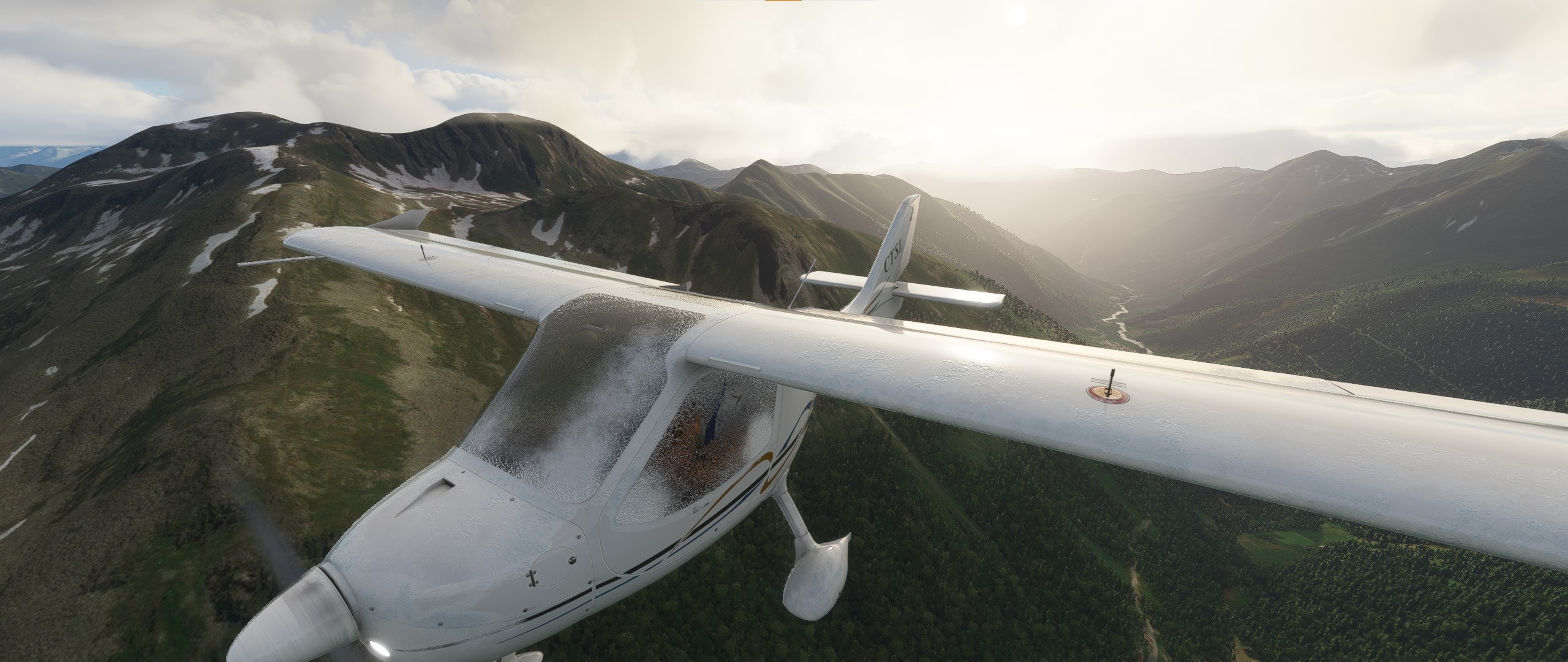
The scenery of the Alps was spectacular.

Comparing the scenery to Bing maps and Google maps, it seemed accurate.
Flying through the valleys was not hard, but choosing the correct valley at a Y junction was challenging. If you make the wrong choice you could end up in a very steep box canyon.

Some geological features were replicated. The land was not just covered in trees and grass.
When I diverted to view a gorgeous mountain lake at 8000 feet, and went through a high mountain pass, ice formed, and rather quickly! That was an emergency.

The ice effect on the inside of the windows was well done! Even at full power the airplane was descending.

After descending and turning on the cabin heat to defrost the windows, the ice melted. Flying above the base of the clouds is about where I suspect the icing started.
There were very picturesque farms and settlements nestled on the slopes.

It occured to me that something was wrong with the scenery. Here I am flying in the Alps in December ... where's the snow??
But, the rock walls in this valley do look very nice for SUMMER!

Another beautiful valley, but no snow. All of the valleys have rivers flowing through them.

This mountain trail is not for cars - it is currently used for mountain biking and hiking! Paradise. The little hut is accurate too. We are above the small town of Mathon, Austria.

Near the Swiss border at the Oberalp pass, snow began to appear. That made the scenery much better for a winter flight!

Quite rocky and rugged terrain. The camera simulates lens flare and high dynamic range effects.

Now we see snow covered mountains and valleys. The mountains are mostly in shadow from the clouds, which makes the lighting dramatic.

After rounding a mountain in the Rhone river valley, our destination airport comes into view.

On final approach to the Sion airport, which does have an instrument landing capability.
The atmospheric haze effect in the distance is excellent.

If you (or the co-pilot) handle the radios properly and obey the ATC instructions, the simulator allows you to refuel.

There are some funny aspects of the logbook entry. I don't know why it shows two landings.
Also the elapsed for this flight time seems to be real world time, not simulated flying time.
The airplane cruised at nearly 200 kts, and the total direct distance was about 200 nm. Even accounting for meandering in the valleys, the elapsed time was for the flight was five hours? The engine time meter in the airplane showed about five hours also. The logbook shows 5:10:55 for the flight. That seems to be the wall clock elapsed time.
I took real time out for a lunch break etc., with the simulator paused. It seems the clock did not stop. Interestingly the sun moved and time passed in the sim world. I left Innsbruck around sunrise, and got to Sion near sunset.
The next day I flew from Sion to Zermatt, and toured the Matterhorn.

The Matterhorn mountain seems to be captured in low elevation resultion, making it look rounded. The actual mountain is much more rocky, according to Google Earth, photos, and of course the replica here at Disneyland California.

Map data © Google and Maxar Technologies, Landsat / Copernicus, CNES / Airbus, NOAA, Flotron

It's still very pretty to fly around in the glacier valley.
The video below is of flying over the town of Zermatt, which is at the base of the Matterhorn, and down the valley back to Sion.
The end.